Our products - Real-World Databases

Real-World Databases are PC-focused and OpenFlight / TerraPage compatible. Available baseline products include geo-typical and geo-specific visual / sensor databases and fully-correlated CTDB for SAF environments.
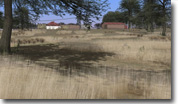
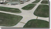
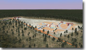
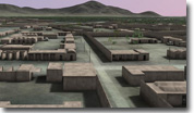
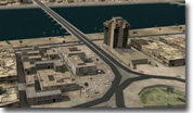
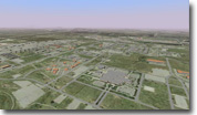
Geo-specific databases include aerial and satellite imagery (including high-resolution, 1-meter per-pixel or better) mapped onto real-world elevation data plus high-fidelity 3D models -- airfields (with selectable/adjustable lighting) buildings, cultural lighting, MOUT buildings, waypoint features, trees, power lines, etc. Furthermore, additional cultural features and realistic 2D and 3D water with reflections can be included.

 |